Tupananchikkama (until we meet again)
That’s what we whispered as we peered over our shoulders to catch a glimpse of Huayna Picchu one last time.
…continued from Tupananchikkama (Peru: Part I)
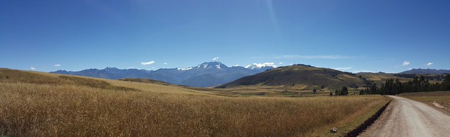
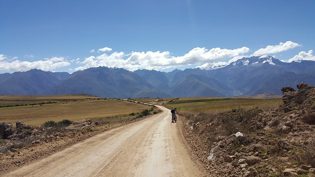
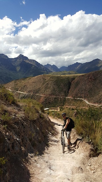
The next day, I had booked us what I thought would be an casual bike ride through the Sacred Valley of Peru. Boy, was I wrong! Why did I not learn from the last time I did any sort of physical activity at 11,000+ feet?! I usually love biking uphill because I’m all about working out that bootayy, but man, even biking the slightest incline was extremely difficult at this altitude. Our lungs were NOT prepared for this shit.
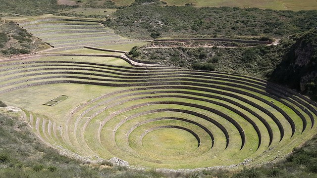
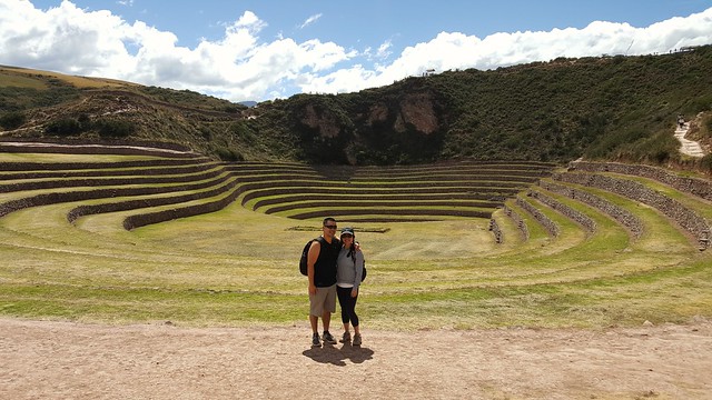
There were two stops on this tour. The first stop was Moray, an Incan ruin believed to have once been used as an agricultural laboratory of sorts. Each level of the circular terraced bowl exhibited a different micro climate, allowing the Incans to experiment with various vegetation.
While we did not bike to Moray (thank goodness), we did bike to our next stop: Maras. The path went from wide open and fairly flat to narrow, downhill, on the side of the mountain.

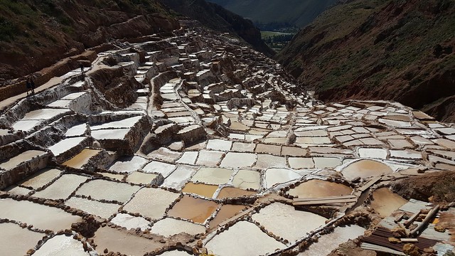
The town of Maras is known for the salt ponds that sit on the slopes of the Qaqawiñay mountain. Some 3,000 shallow pools are filled with the hypersaline water that flows through an intricate network of channels from the Qoripujio spring. Once full, the water in the ponds is left to evaporate and the remaining deposits are raked into a basket to be sorted, bagged and sold. An admission fee of 10 soles and a short hike from the small parking lot take you down to the salt mines. We bought a few bags of salt to take home for ourselves and as gifts for our foodie friends. Based on what we purchased, the grain size is a bit more coarse than I’m used to so I would definitely recommend for use as a finishing salt rather than a salt to cook with. The taste is more salty, for the lack of a better description.
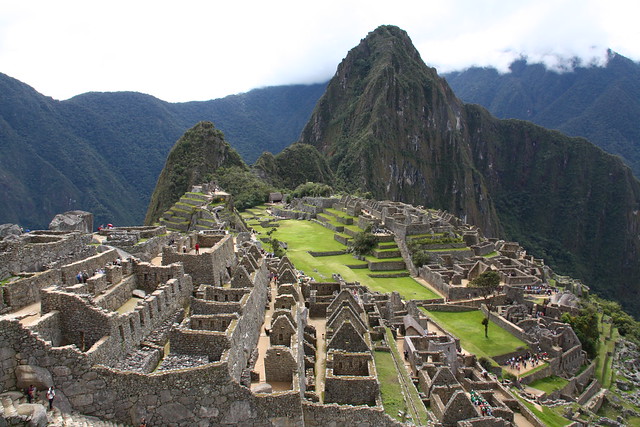
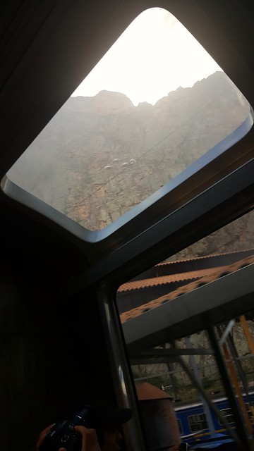
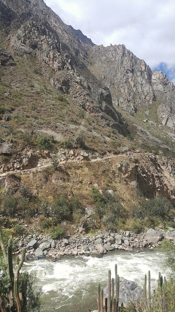
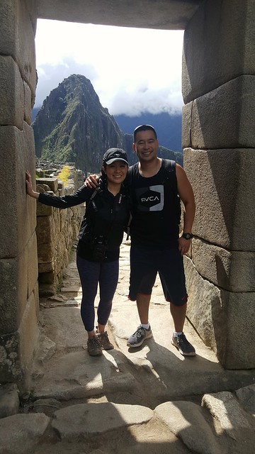
And (drum roll) for the main event, we traveled to Machu Picchu bright and early the next morning aboard the Vistadome train. This train was an upgrade from the normal Expedition train, but the panoramic windows and food service offered both ways were well worth the extra cost.
Our journey began with 20 min car ride to the Poroy Train Station and from there, it took 3.5 hours to get to Machu Picchu by train (~ 4 hours one way). The Poroy Station is only open from May through December so for those considering traveling from January through April, the trip from Cusco to Machu Picchu consists of a long BUS ride to the Ollantaytambo Station and then taking a train from there (~4.5 hours one way).
Given the limited vacation days we had for this trip, we decided against trekking to Machu Picchu. Although now looking back, I probably would have given up one day in Lima for a day trek to Machu Picchu.
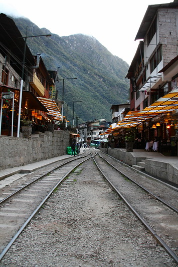
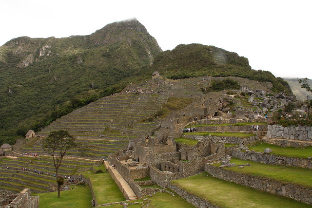
The last stop of the train was the Machu Picchu Train Station, located in Machu Picchu Town aka Aguas Calientes. From the train station, we walked 10 min into town to the bus station and after a 30 min bus ride, we were finally at the entrance. FINALLY. After almost 5 hours. FIVE. CINCO.

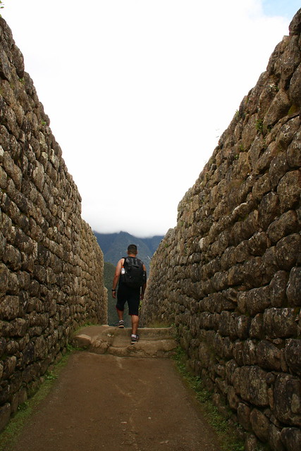
We met up with our tour guide and got to exploring this new wonder of the world.
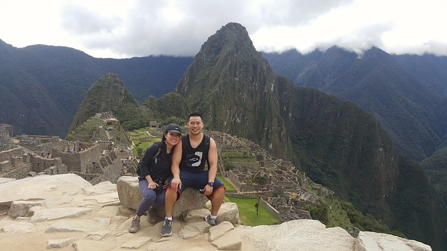
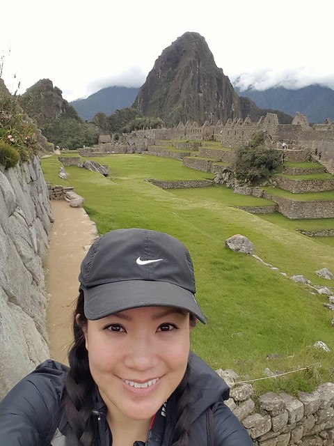
Bucket list √


